Airport pavement inspection, where satellite screening fits in a maintenance programme
For airport maintenance teams, the value of satellite data depends on how well it supports airport pavement inspection.
Every airport with paved runways, taxiways and aprons runs some form of pavement maintenance. Teams walk or drive the airfield, record distress, rate condition and plan repairs. The process is well established and it works.
What it does not easily show is the ground underneath. A crack tells you there is a problem at the surface; it does not tell you whether the layers below have been settling for two years, or whether the slab next to it is about to follow.
This article looks at how pavement maintenance programmes are organised, what they measure and where satellite ground screening can add something useful. If you are responsible for airfield pavements, take a look.
Category: Airport operations
Airport pavement inspection is the base of every maintenance programme
The FAA’s AC 150/5380-6C, Guidelines and Procedures for Maintenance of Airport Pavements describes routine inspection, types of distress and maintenance and repair methods for airport pavements. It treats regular inspection as the way problems are found before they grow.
Its companion, AC 150/5380-7B on Airport Pavement Management Programs, explains how inspection results are recorded and used to plan maintenance over time, so that budgets go where they do the most good.
Together they describe a cycle: inspect, record, rate, plan, repair and inspect again. Any new data source is only useful if it fits that cycle.
Where satellite screening fits in the maintenance cycle
Satellite AI flags cells where the ground moves unusually.
Teams add flagged cells to the next inspection round.
Findings go into the pavement management records.
Budgets and repairs follow confirmed problems.
The cycle repeats every 12 to 15 days as new satellite data arrives.
Surface surveys see distress, not the ground that causes it
Visual and condition surveys are very good at recording what is visible: cracking, joint damage, surface deformation and drainage problems. They are less able to show what is happening below the surface before it appears.
Ground movement under a pavement can be slow and uneven. By the time it shows up as distress, the cause may have been active for some time and may extend beyond the area that is visibly damaged.
Detailed investigations such as levelling, coring or deflection testing can answer these questions, but they are costly and are usually done where a problem is already suspected.
This is not a weakness of the method. Surface surveys were designed to describe pavement condition, and they do that well. The gap is simply that the ground underneath is outside what they were built to measure.
Airport pavement inspection becomes more targeted with a whole-site screening
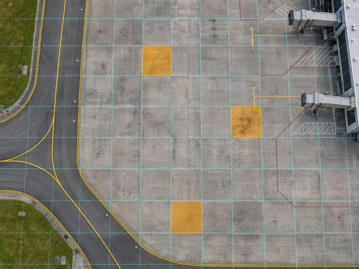
This is where satellite screening fits. Radar satellites measure ground movement across the whole airport on a regular schedule, so they can point to areas where the ground is moving unusually, including places that look fine at the surface.
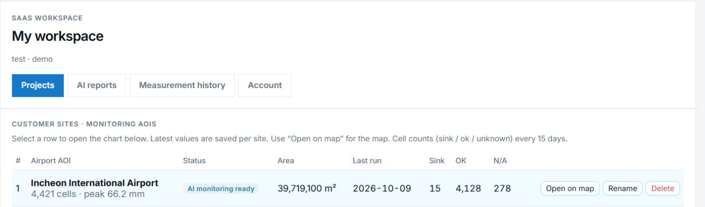
In TOWER the airport is divided into 90 m cells and assessed every 12 to 15 days. The AI flags cells that need attention and produces a short list, which the maintenance team can add to its next inspection round or use to decide where a detailed investigation is worth the cost.
At Incheon International Airport, the December 2025 screening flagged 25 of 4,421 cells, about 0.6 percent of the grid. That is a manageable number of places to check, rather than a reason to inspect everything again.
Field results close the loop and improve the next round
A flagged cell is a suggestion, not a diagnosis. The inspection or survey that follows confirms whether there is a problem, what kind it is and whether action is needed.
Recording those results alongside the screening builds a history for each area of the airfield. Over time it becomes clearer which zones settle steadily, which react to seasons and which stay stable.
TOWER is a screening service. It does not replace levelling surveys, condition ratings or engineering judgement, and it does not decide runway closures. Its job is to help the people who make those decisions look in the right place first.
Many airports already keep their inspection records in a pavement management system. Screening results can sit alongside those records, so the history of each area includes both what was seen on the surface and how the ground underneath moved.
So far we have explained how satellite screening can support airport pavement maintenance. You can see what a TOWER priority report contains on our AI priority reports page.
Frequently asked questions
Does satellite screening replace condition surveys?
No. Condition surveys record surface distress and remain essential. Screening adds information about ground movement and helps decide where to look first.
How would flagged cells fit into our inspection routine?
They can be added to the next scheduled inspection or used to decide where detailed tests such as levelling or deflection testing are worth doing.
How much of the airport is usually flagged?
It varies with each observation. At Incheon, flagged cells ranged from 0 to 43 out of 4,421 across 13 observations, and 25 in December 2025.
Not sure where to check first at your airport?
We can start with a screening of your whole airport from public satellite data.
Discuss a PoC →Edited and answered by the MomentCube TOWER team / james@momentcube.com · +82-32-212-1011